Picture Gallery |
||
    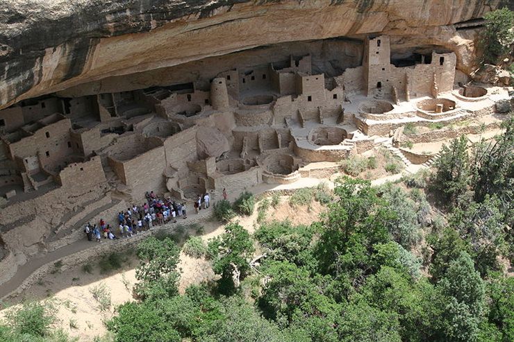 Ancient Pueblo People or Ancestral Puebloans were an ancient Native American culture centered on the present-day Four Corners area of the United States, comprising southern Utah, northern Arizona, northwest New Mexico, and a lesser section of Colorado. The cultural group has often been referred to in archaeology as the Anasazi, although the term is not preferred by the modern Puebloan peoples. The word Anasazi is Navajo for "Ancient Ones" or "Ancient Enemy". Archaeologists still debate when this distinct culture emerged, but the current consensus, based on terminology defined by the Pecos Classification, suggests their emergence around 1200 BC, during the archaeologically designated Basketmaker II Era. Beginning with the earliest explorations and excavations, researchers have believed that the Ancient Puebloans are ancestors of the modern Pueblo peoples. (based on a wikipedia article / cc by-sa)  Tikal (or Tik’al according to the modern Mayan orthography) is one of the largest archaeological sites and urban centres of the pre-Columbian Maya civilization. It is located in the archaeological region of the Petén Basin in what is now northern Guatemala. Situated in the department of El Petén, the site is part of Guatemala's Tikal National Park and in 1979 it was declared a UNESCO World Heritage Site. Population estimates for Tikal vary from 10,000 to as high as 90,000 inhabitants, with the most likely figure being at the upper end of this range. Because of the low salt content of the Maya diet, it is estimated that Tikal would have had to import 131 tons of salt each year, based on a conservative population estimate of 45,000. (based on a wikipedia article / cc by-sa) 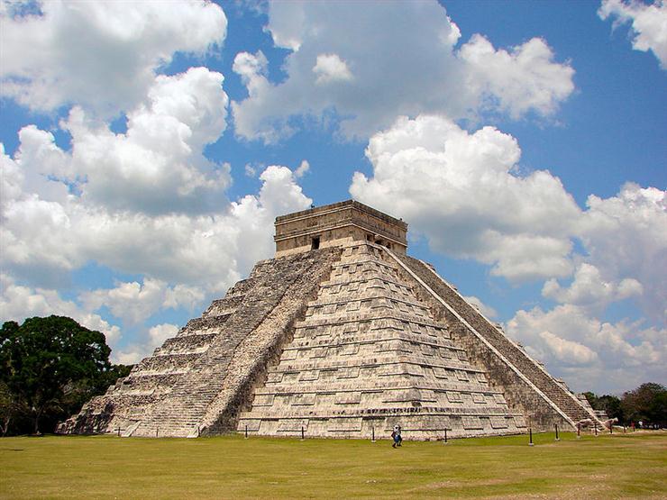 Chichen Itzais a large pre-Columbian archaeological site built by the Maya civilization located in the northern center of the Yucatán Peninsula, in the Yucatán state, present-day Mexico. The site contains many fine stone buildings in various states of preservation, and many have been restored. The buildings are connected by a dense network of formerly paved roads, called sacbeob. Archaeologists have found almost 100 sacbeob criss-crossing the site, and extending in all directions from the city. The buildings of Chichén Itza are grouped in a series of architectonic sets, and each set was at one time separated from the other by a series of low walls. (based on a wikipedia article / cc by-sa)  Kourion (Greek: Κούριον), also Curias (Pliny v. 13) or Latin: Curium, was a city in Cyprus, which endured from antiquity until the early Middle Ages. Kourion is situated on the south shores of the island to the west of the river Lycus (now called Kouris), 16 M. P. from Amathus. (Peut. Tab.), and was recorded by numerous ancient authors including Ptolemy (v. 14. § 2), Stephanus of Byzantium, Hierocles, and Pliny the Elder. Kourion was said to have been founded by the Argives. Stesenor, its sovereign, betrayed the cause of his country during the war against the Persians. (Herod. l. c.) Near the town was a cape (Φρούριον, Ptol. v. 14. § 2), from which sacrilegious offenders who had dared to touch the altar of Apollo were thrown into the sea. (Strab. l. c.). (based on a wikipedia article / cc by-sa) 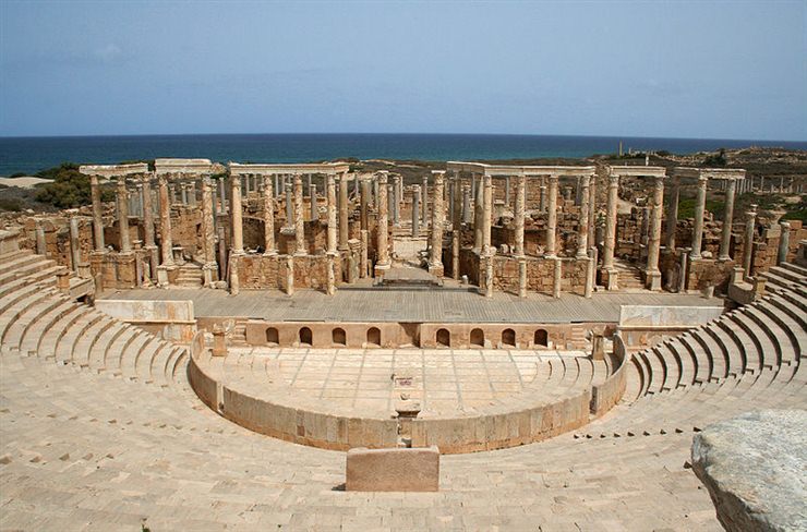 Leptis Magna,(Arabic: لبده) also known as Lectis Magna (or Lepcis Magna as it is sometimes spelled), also called Lpqy or Neapolis, was a prominent city of the Roman Empire. Its ruins are located in Al Khums, Libya, 130 km east of Tripoli, on the coast where the Wadi Lebda meets the sea. The site is one of the most spectacular and unspoiled Roman ruins in the Mediterranean. The city appears to have been founded by Phoenician colonists sometime around 1100 BC, although it did not achieve prominence until Carthage became a major power in the Mediterranean Sea in the 4th century BC. It nominally remained part of Carthage's dominions until the end of the Third Punic War in 146 BC and then became part of the Roman Republic, although from about 200 BC onward, it was for all intents and purposes an independent city. (based on a wikipedia article / cc by-sa) 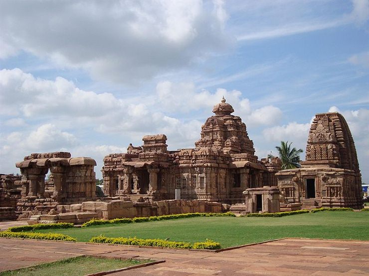 Pattadakal (Kannada – ಪಟ್ಟದ್ಕಲ್ಲು) is a town in the Indian state of Karnataka The town lies on the banks of the Malaprabha River in Bagalkot district of North Karnataka region. It is 22 km from Badami and about 10 km from Aihole. The group of 8th century CE monuments in Pattadakal are the culmination of the earliest experiments in the vesara style of Hindu temple architecture. They were designated a World Heritage Site in 1987. The town displays both Dravidian (Southern) and the Nagara (Northern, Indo-Aryan) styles of temple architecture. Pattadakal, the capital of the Chalukya dynasty of Southern India, who built the temples in the seventh and eighth centuries. There are ten temples including a Jain sanctuary surrounded by numerous small shrines and plinths. (based on a wikipedia article / cc by-sa)  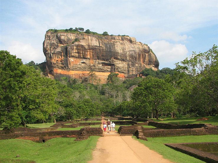 Sigiriya (Lion's rock) is an ancient rock fortress and palace ruin situated in the central Matale District of Sri Lanka, surrounded by the remains of an extensive network of gardens, reservoirs, and other structures. A popular tourist destination, Sigiriya is also renowned for its ancient paintings (frescos), which are reminiscent of the Ajanta Caves of India. The Sigiriya was built during the reign of King Kassapa I (AD 477 – 495), and it is one of the seven World Heritage Sites of Sri Lanka. In 477 A.D, prince Kasyapa seized the throne from King Dhatusena, following a coup assisted by Migara, the king’s nephew and army commander. Kasyapa, the king’s son by a non-royal consort, usurped the rightful heir, Moggallana, who fled to South India. (based on a wikipedia article / cc by-sa) 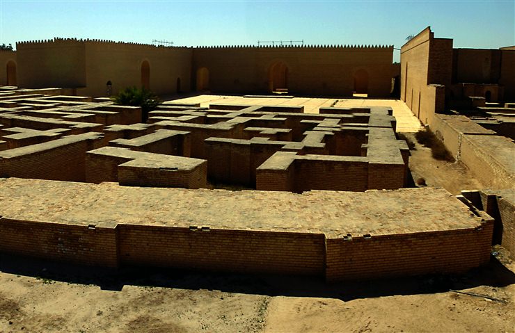 Babylon (Greek Βαβυλών, from Akkadian: Babili, Babilla) was a city-state of ancient Mesopotamia, the remains of which are found in present-day Al Hillah, Babil Province, Iraq, about 85 kilometers (55 mi) south of Baghdad. All that remains of the original ancient famed city of Babylon today is a mound, or tell, of broken mud-brick buildings and debris in the fertile Mesopotamian plain between the Tigris and Euphrates rivers. The Greek form Βαβυλών is an adaptation of Babylonian Babili. The Babylonian name as it stood in the 1st millennium BC had been changed from an earlier Babilli in early 2nd millennium BC, interpreted as "gateway of the god" (bāb-ili) by popular etymology. The earlier name Babilla appears to be an adaptation of a non-Semitic source of unknown origin or meaning. (based on a wikipedia article / cc by-sa) 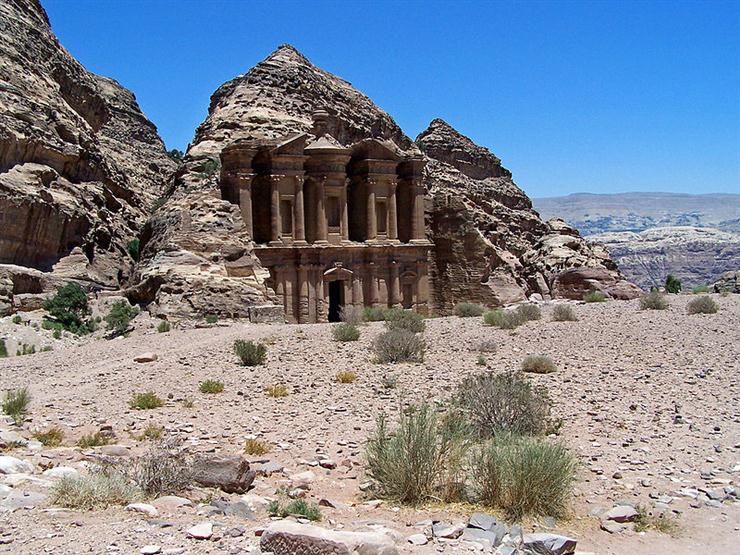 Petra (Greek "πέτρα" (petra), meaning rock; Arabic: البتراء, Al-Batrāʾ) is a historic and archaeological city in the Jordanian governorate of Ma'an that has rock cut architecture and a water conduits system. Established sometime around the 6th century BC as the capital city of the Nabataeans, it is a symbol of Jordan as well as its most visited tourism attraction. It lies on the slope of Mount Hor in a basin among the mountains which form the eastern flank of Arabah (Wadi Araba), the large valley running from the Dead Sea to the Gulf of Aqaba. Petra has been a UNESCO World Heritage Site since 1985. The site remained unknown to the Western world until 1812, when it was introduced by Swiss explorer Johann Ludwig Burckhardt. (based on a wikipedia article / cc by-sa) 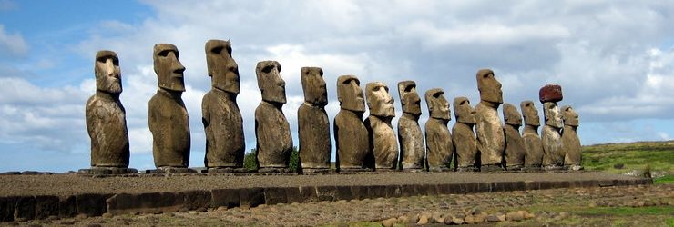 Easter Island is a Polynesian island in the southeastern Pacific Ocean, at the southeastern most point of the Polynesian triangle. A special territory of Chile annexed in 1888, Easter Island is widely famous for its 887 extant monumental statues, called moai, created by the early Rapanui people. It is a World Heritage Site with much of the island protected within the Rapa Nui National Park. The history of Easter Island is rich and controversial. Its inhabitants have endured famines, epidemics, civil war, slave raids and colonialism, and near deforestation; their population has declined precipitously more than once. They have left a cultural legacy that has brought them fame disproportionate to their population. (based on a wikipedia article / cc by-sa) 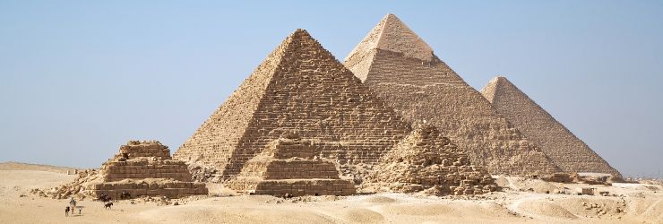 The Great Pyramid of Giza (also called the Pyramid of Khufu and the Pyramid of Cheops) is the oldest and largest of the three pyramids in the Giza Necropolis bordering what is now El Giza, Egypt, and in a historical irony is the oldest of the Seven Wonders of the Ancient World and the only one that survives substantially intact. It is believed the pyramid was built as a tomb for fourth dynasty Egyptian Pharaoh Khufu (Cheops in Greek) and constructed over a 20 year period concluding around 2551 BC. The Great Pyramid consists of more than 2.3 million limestone blocks (unless it was built on a substantial core of natural rock, which is possible). The Egyptians obtained the majority of the limestone blocks from a nearby quarry. The Tura limestone used for the casing was quarried across the river. The largest granite stones in the pyramid, found in the “King’s” chamber, weigh 25 to 80 tonnes and were transported more than 500 miles away from Aswan. (based on a wikipedia article / cc by-sa) 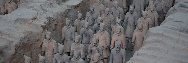 The Terracotta Army is the Terra Cotta Warriors and Horses of Qin Shi Huang the First Emperor of China. The terracotta figures, dating from 210 BC, were discovered in 1974 by some local farmers near Xi’an, Shaanxi province, China near the Mausouleum of the First Qin Emperor. The figures vary in height (183–195 cm – 6 ft–6 ft 5in), according to their role, the tallest being the generals. The figures include warriors, chariots, horses, officials, acrobats, strongmen, and musicians. Current estimates are that in the three pits containing the Terracotta Army there were over 8,000 soldiers, 130 chariots with 520 horses and 150 cavalry horses, the majority of which are still buried in the pits. Many archeologists believe that there are many pits still waiting to be discovered. (based on a wikipedia article / cc by-sa)  The Leshan Giant Buddha was built during the Tang Dynasty (618–907). It is carved out of a cliff face that lies at the confluence of the Minjiang, Dadu and Qingyi rivers in the southern part of Sichuan province in China, near the city of Leshan. The stone sculpture faces Mount Emei, with the rivers flowing below his feet. It is the largest carved stone Buddha in the world and at the time of its construction was the tallest statue in the world. At 71 metres (233 feet) tall, the statue depicts a seated Maitreya Buddha with his hands resting on his knees. His shoulders are 28 metres wide and his smallest toenail is large enough to easily accommodate a seated person. (based on a wikipedia article / cc by-sa) Over time, water erodes the soil under the planet's surface until in some cases, quite suddenly, 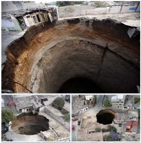 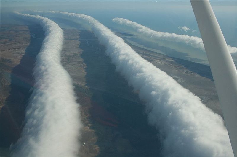 One of the rarest cloud formations is a roll cloud, which is a low-lying tube-shaped cloud that appears to roll through the sky like a baker’s rolling pin. It’s so rare that most people will never see a roll cloud in their life. But there’s one spot on earth where roll clouds appear often. They call it the Morning Glory cloud, but we think a more accurate title would be the Morning Wood cloud. Sometimes there’s just one, sometimes there’s up to eight in a row, and they can stretch up to 1,000 kilometers in length. Blue holes are giant and sudden drops in underwater elevation 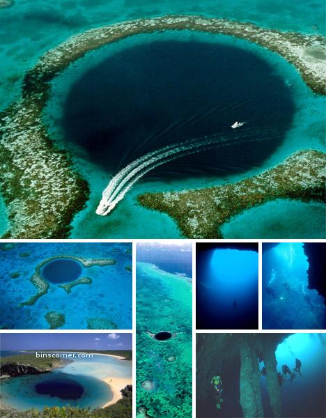 PADMANABHAPURAM PALACE Padmanabhapuram Palace (Tamil: பத்மநாபபுரம் அரண்மனை, Malayalam:പത്മനാഭപുരം കൊട്ടാരം) complex is located in at Padmanabhapuram Fort, close to the town ofThuckalay in Kanyakumari District, Tamilnadu. It is about 20 km from Nagercoil, and about 50 kilometers from Thiruvananthapuram, Kerala. The palace complex is inside an old granitefortress around four kilometers long. The palace is located at the foot of the Veli Hills, which form a part of the Western Ghats. The river Valli flows nearby.[1] The palace is administered by the Government of Kerala archeology department. The palace was constructed around 1601 AD by Iravipillai Iravivarma Kulasekhara Perumal who ruled Travancore between 1592 AD and 1609 AD. In the late 18th century, the capital of Travancore was shifted from here to Thiruvananthapuram, and the place lost its former glory. However, the palace complex continues to be one of the best examples of traditional Kerala architecture, and some portions of the sprawling complex are also the hallmark of traditional Kerala style architecture. The Padmanabhapuram Palace complex consists of several structures:
Mantrasala (Council chamber)King’s Council chamber is the most beautiful part of the entire palace complex. It haswindows, with coloured mica, which keep the heat and the dust away, and the interior of the council chamber remains cool and dark. Delicate and beautiful lattice work can be seen all over the council chamber. The floor is also beautifully done, with a fine and perfect finish. The floor is dark and is made of a mixture of varied substances, including burnt coconut shells, egg white and so on. The remarkable aspect is that this particular floor finish and texture could not be duplicated in any other construction. [edit]Thai Kottaram (Mother's palace)Mother’s palace, designed in traditional Kerala style, is the oldest construction in the entire palace complex and is believed to be constructed around mid-16th century. True to the traditional Kerala style, there is an inner courtyard, called 'nalukettu'. In the inner courtyard, sloping roofs from all four sided taper down. Four pillars on four corners support the roof. On the south-west corner of the mother’s palace, there is a relatively small room, called the chamber of solitude or 'ekantha mandapam'. The chamber of solitude has very beautiful and intricate wood carvings of every description all around. Of particular interest is a pillar of single jackfruit wood, with very detailed and beautiful floral designs. [edit]Nataksala (Hall of performance)This is a relatively new building, constructed at the behest of Maharaja Swathi Thirunal, who reigned in Travancore from 1829 to 1846. He was a great connoisseur of arts, especiallymusic and dance. He himself composed music and has left a rich legacy to classicalcarnatic music. The Nataksala or the hall or performance has solid granite pillars and gleaming black floor. There is a wooden enclosure, with peepholes, where the women of the royal household used to sit and watch the performance. [edit]Four-storeyed central building (UPPIRIKKA MALIGA)The four-storied building is located at the centre of the palace complex. The ground floor houses the royal treasury. The first floor houses the King's bedrooms. The ornamental bedstead is made of 64 types of herbal and medicinal woods, and was a gift from the Dutch merchants. Most of the rooms here and in other parts of the palace complex have built-in recesses in walls for storing weapons like swords and daggers. The second floor houses the King's resting and study rooms. Here the King used to spend time during fasting days. The top floor (calledupparikka malika) served as the worship chamber of the royal household. Its walls are covered with exquisite 18th century murals, depicting scenes from the puranas, and also few scenes from the social life of the Travancore of that time. Ths top floor was supposed to be Sree Padmanabha Swamy's room. This building was constructed during the reign of King Marthandavarma. He was also designated as Padmanabha Dasa and used to rule the Travancore kingdom as a servant of Sree Padmanabha Swamy. [edit]Thekee kottaram (Southern palace)The southern palace is as old as the ‘Thai kottaram’ (Mother's palace), which would make it about 400 year old. Now, it serves as a heritage museum, exhibiting antique household articles and curios. Collections of items give an insight into the social and cultural ethos of that period. [edit]Other interesting featuresThe Padamnabhapuram Palace complex has several other interesting features:
SOME GOOD PICTURES OF THE GREAT PALACE OF PADMANABHAPURAM       |
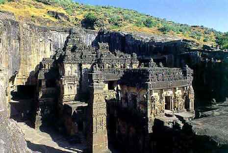 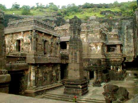 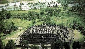 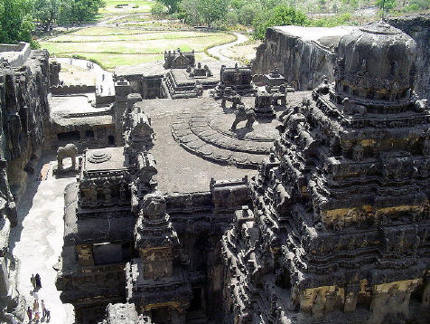 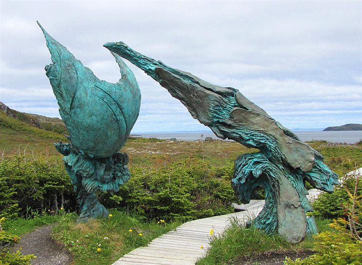 L'Anse aux Meadowsis an archaeological site on the northernmost tip of the island of Newfoundland in the Canadian province of Newfoundland and Labrador. Discovered in 1960, it is the only known site of a Norse village in Canada, and in North America outside of Greenland. The site remains the only widely-accepted instance of pre-Columbian trans-oceanic contact, and is notable for possible connections with the attempted colony of Vinland established by Leif Ericson around 1003, or more broadly with Norse exploration of the Americas. The name "L'Anse aux Meadows" made its first appearance as Anse à la Medée on a map of 1862, when it may have derived its name from a ship called Medée. (based on a wikipedia article / cc by-sa)  Machu Picchuis a pre-Columbian Inca site located 2,430 metres (7,970 ft) above sea level. It is situated on a mountain ridge above the Urubamba Valley in Peru, which is 80 kilometres (50 mi) northwest of Cuzco and through which the Urubamba River flows. Most archaeologists believe that Machu Picchu was built as an estate for the Inca emperor Pachacuti (1438–1472). Often referred to as "The Lost City of the Incas", it is perhaps the most familiar icon of the Inca World. One of the earliest theories about the purpose of the citadel, by Hiram Bingham, is that it was the traditional birthplace of the Incan "Virgins of the Suns". Research conducted by scholars, such as John Rowe and Richard Burger, has convinced most archaeologists that Machu Picchu was an estate of the Inca emperor, Pachacuti. (based on a wikipedia article / cc by-sa)  Palenque (Bàak' in Modern Maya) was a Maya city state in southern Mexico that flourished in the seventh century CE. After its decline it was absorbed into the jungle, but has been excavated and restored and is now a famous archaeological site attracting thousands of visitors. It is located near the Usumacinta River in the Mexican state of Chiapas, located about 130 km south of Ciudad del Carmen (see map) about 150 meters above sea-level. Palenque is a medium-sized site, much smaller than such huge sites as Tikal or Copán, but it contains some of the finest architecture, sculpture, roof comb and bas-relief carvings the Maya produced. (based on a wikipedia article / cc by-sa)  Memphis (Arabic: ممفس; Egyptian Arabic: ممفيس; Greek: Μέμφις) was the ancient capital of Aneb-Hetch, the first nome of Lower Egypt. Its ruins are located near the town of Helwan, south of Cairo. The history of Memphis is closely linked to that of the country itself. Its eventual downfall is believed to be due to the loss of its economical significance in late antiquity, following the rise of coastal Alexandria. Its religious significance also diminished after the abandonment of the ancient religion following the Edict of Thessalonica. Memphis has had several names during its history of almost four millennia. Its Ancient Egyptian name was Inebou-Hedjou, and later, Ineb-Hedj (translated as "the white walls"), because of its majestic fortifications and crenellations. (based on a wikipedia article / cc by-sa) 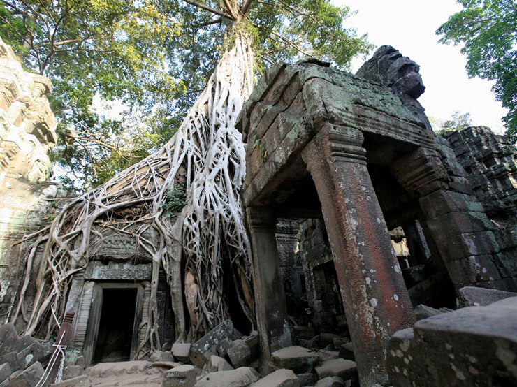 Angkor (Khmer: អង្គរ) is a region of Cambodia that served as the seat of the Khmer Empire, which flourished from approximately the ninth century to the thirteenth century. The word Angkor is derived from the Sanskrit nagara (नगर), meaning "city". The Angkorian period began in AD 802, when the Khmer Hindu monarch Jayavarman II declared himself a "universal monarch" and "god-king", until 1431, when Ayutthayan invaders sacked the Khmer capital, causing its population to migrate south to the area of Phnom Penh. The temples of the Angkor area number over one thousand, ranging in scale from nondescript piles of brick rubble scattered through rice fields to the magnificent Angkor Wat, said to be the world's largest single religious monument. (based on a wikipedia article / cc by-sa) 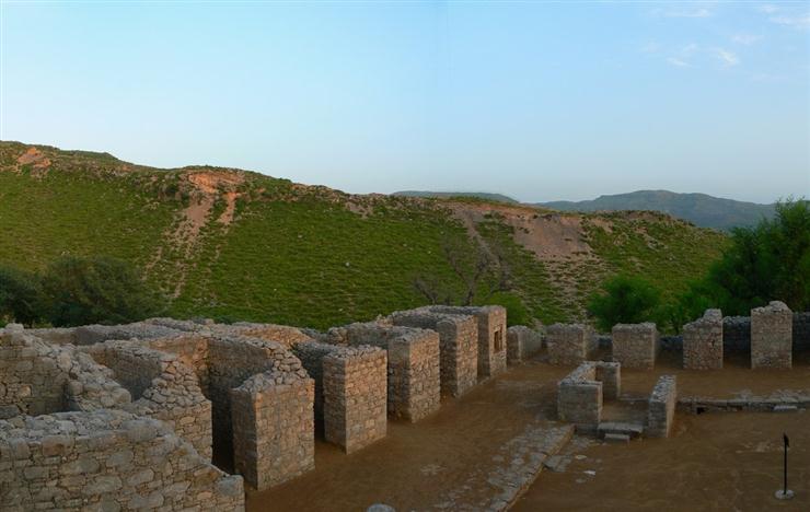 Taxila from Sanskrit: तक्षशिला Takṣaśilā (Urdu, Punjabi: ٹیکسلا) is a city, and home to an important archaeological site in the Punjab province of Pakistan. Taxila is situated about 32 km (20 mi) to the north-west of Islamabad Capital Territory and Rawalpindi in Panjab; just off the Grand Trunk Road. Taxila lies 549 metres (1,801 ft) above sea-level. 3. The Sindu (English: Indus) route from Kashmir and Central Asia, via Śri nagara, Mansehra, and the Haripur valley across the Khunjerab pass to the Silk Road in the north to the Indian Ocean in the south. To fully understand the importance of Takṣaśilā it must be noted that the Khunjerab pass between Kashmir and Xinjiang – the current Karakoram highway – was already traversed in antiquity. (based on a wikipedia article / cc by-sa) 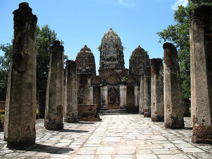 The Sukhothai Historical Park (Thai: อุทยานประวัติศาสตร์สุโขทัย (Pronunciation)) covers the ruins of Sukhothai, capital of the Sukhothai kingdom in the 13th and 14th centuries, in what is now the north of Thailand. It is located near the modern city of Sukhothai, capital of the province with the same name. The city walls form a rectangle about 2 km east-west by 1.6 km north-south. There are 193 ruins on 70 square kilometers of land. There is a gate in the centre of each wall. Inside are the remains of the royal palace and twenty-six temples, the largest being Wat Mahathat. The park is maintained by the Fine Arts Department of Thailand with help from UNESCO, which has declared it a World Heritage Site. (based on a wikipedia article / cc by-sa) 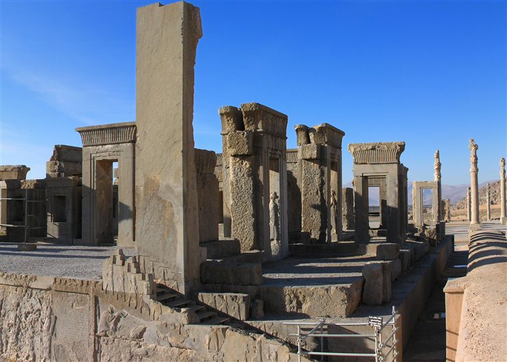 Persepolis was the ceremonial capital of the Achaemenid Empire (ca. 550-330 BCE). Persepolis is situated 70 km northeast of the modern city of Shiraz in the Fars Province of modern Iran. In contemporary Persian, the site is known as Takht-e Jamshid (Throne of Jamshid) and Parseh. The earliest remains of Persepolis date from around 515 BCE. To the ancient Persians, the city was known as Pārsa, which means "The City of Persians". (based on a wikipedia article / cc by-sa)  The ruins of the city are located on the east bank of the Tigris, across the river from the Hellenistic city of Seleucia. Today, the remains of both cities lie in Iraq, approximately 35 km south of the city of Baghdad. Ctesiphon is first mentioned in the Book of Ezra of the Old Testament as Kasfia/Casphia (a derivative of the ethnic name, Cas, and a cognate of Caspian and Qazvin). In the 6th century, Ctesiphon was the largest city in the world. The Latin name 'Ctesiphon' or 'Ctesifon'derives from Greek 'T(h)esifon' or 'Et(h)esifon', continuing in later Greek as 'Ktēsiphōn' (Κτησιφῶν). (based on a wikipedia article / cc by-sa)  Teotihuacan is an enormous archaeological site in the Basin of Mexico, containing some of the largest pyramidal structures built in the pre-Columbian Americas. Apart from the pyramidal structures, Teotihuacan is also known for its large residential complexes, the Avenue of the Dead, and numerous colorful, well-preserved murals. At its zenith in the first half of the 1st millennium CE, Teotihuacan was the largest city in the pre-Columbian Americas. At this time it may have had more than 200,000 inhabitants, placing it among the largest cities of the world in this period. The civilization and cultural complex associated with the site is also referred to as Teotihuacan or Teotihuacano. (based on a wikipedia article / cc by-sa) 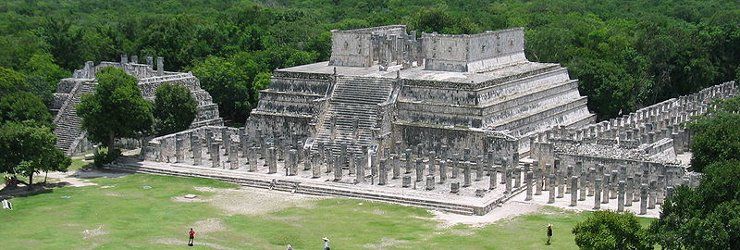 Chichen Itza is a large pre-Columbian archaeological site built by the Maya civilization located in the northern center of the Yucatán Peninsula, in the Yucatán state, present-day Mexico. Chichen Itza was a major focal point in the northern Maya lowlands from the Late Classic through the Terminal Classic and into the early portion of the Early Postclassic period. The site exhibits a multitude of architectural styles, from what is called “Mexicanized” and reminiscent of styles seen in central Mexico to the Puuc style found among the Puuc Maya of the northern lowlands. The presence of central Mexican styles was once thought to have been representative of direct migration or even conquest from central Mexico, but most contemporary interpretations view the presence of these non-Maya styles more as the result of cultural diffusion. (based on a wikipedia article / cc by-sa) 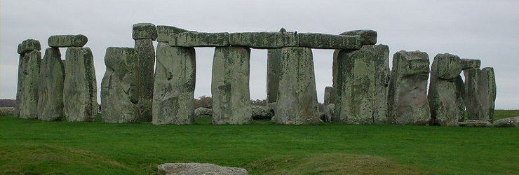 Stonehenge is a prehistoric monument located in the English county of Wiltshire, about 3.2 kilometres (2.0 mi) west of Amesbury and 13 kilometres (8.1 mi) north of Salisbury. One of the most famous sites in the world, Stonehenge is composed of earthworks surrounding a circular setting of large standing stones. It is at the centre of the most dense complex of Neolithic and Bronze Age monuments in England, including several hundred burial mounds. Archaeologists had believed that the iconic stone monument was erected around 2500 BC, as described in the chronology below. One recent theory, however, has suggested that the first stones were not erected until 2400-2200 BC, whilst another suggests that bluestones may have been erected at the site as early as 3000 BC (see phase 1 below). (based on a wikipedia article / cc by-sa) 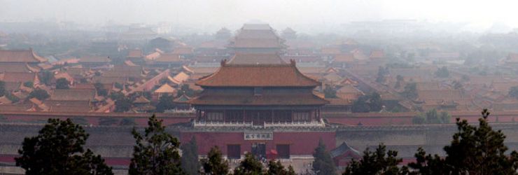 The Forbidden City was the Chinese imperial palace from the Ming Dynasty to the end of the Qing Dynasty. It is located in the middle of Beijing, China, and now houses the Palace Museum. For almost five centuries, it served as the home of the Emperor and his household, as well as the ceremonial and political centre of Chinese government. Since 1925, the Forbidden City has been under the charge of the Palace Museum, whose extensive collection of artwork and artifacts were built upon the imperial collections of the Ming and Qing dynasties. Part of the museum’s former collection is now located in the National Palace Museum in Taipei. Both museums descend from the same institution, but were split after the Chinese Civil War. (based on a wikipedia article / cc by-sa) 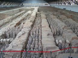 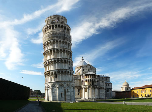 The designers of the tower did not intend for it to lean. The foundation was poorly constructed and was set in loose soil, contributing to a shift that began right after construction of the tower began. The tower used to learn at an angle of 5.5 degrees but restoration efforts during the late 1990’s corrected the lean to only 3.99 degrees. 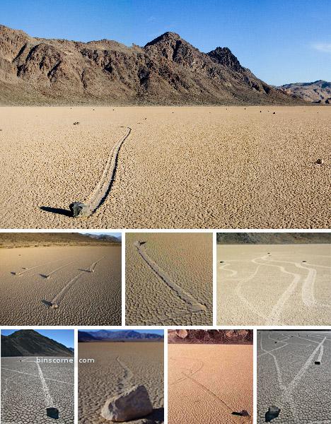 The mysterious moving stones of the packed-mud desert of Death Valley have been a center of scientific controversy for decades. 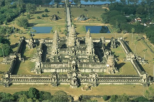 |
|
 ']);
_gaq.push(['_trackPageview']);
(function(){
var ga = document.createElement('script');
ga.type = 'text/javascript';
ga.async = true;
ga.src = ('https:' == document.location.protocol ? 'https://ssl' : 'http://www') + '.google-analytics.com/ga.js';
var s = document.getElementsByTagName('script')[0];
s.parentNode.insertBefore(ga, s);
})();
']);
_gaq.push(['_trackPageview']);
(function(){
var ga = document.createElement('script');
ga.type = 'text/javascript';
ga.async = true;
ga.src = ('https:' == document.location.protocol ? 'https://ssl' : 'http://www') + '.google-analytics.com/ga.js';
var s = document.getElementsByTagName('script')[0];
s.parentNode.insertBefore(ga, s);
})();